Who are we?
The Geoporter Program and its volunteers are teaching youth, teachers and residents in Bahia Ballena, Costa Rica how to
use Geographic Information Systems (GIS) and Global Positioning System (GPS) to make a difference in their community. Residents are using these geospatial technologies to
map and investigate their community to better understand, manage, and take action to make their community sustainable for today and the future. In turn, residents are reaching out to other communities to teach others to do the same. We are Geoporter (Geospatial Educators Opportunities for Partnership Outreach Research and Training).
-
Educate, train, and build capacity of residents in Bahía Ballena and other coastal communities to apply GIS and GPS to investigate, better understand, and take action in environmentally-based community identified projects.
-
Engage teachers and students in formal and informal education settings in project-based learning using geospatial technologies to enhance their communities and apply skills to future paths.
-
Empower communities to apply acquired geospatial and other technological skills to investigate their own community resources and contribute to solving critical global issues.
What are we?
As professional geospatial educators and volunteers, we are traveling and living in communities around the world for extended periods to work hand-in-hand with community members to investigate and map resources and items of interest in their community. Our first community is Bahia Ballena, Costa Rica, a community of 2,000
residents, which in less than a decade has transitioned from a rural fishing economy
to one centered in eco-tourism, with more than 20,000 tourists visiting
annually. Other Costa Rican communities are hearing about us through project partners sharing this project with them. Also, a coastal community in Peru wants a Geoporter. Perhaps you know of an interested community....
What do we do?
Geoporters teach! We teach adults, youth and other teachers in the community how to use GIS and GPS to apply to their interests and local needs they identify. If residents are interested in monitoring whales, they learn how to use the technologies to collect the data on their daily boat tours and then bring that information back to make the maps themselves. If they are interested in removing trash in their streets, which creates
a more beautiful ecotourism destination and keeps pollution out of the oceans, they develop a collection methodology to categorize the collected trash and then map it. For teachers that want to explore ancient civilizations, teachers are learning to develop geospatial activities that explore Egyptian, Inca and Nazca civilizations. To improve math skills, students use GPS units to conduct a Geocaching treasure hunt, with the treasures being math problems.
By teaching, residents are able to do the projects themselves and understand the information they are collecting. With the acquired geospatial and technical skills, they no longer need to rely on non-community members to investigate and provide
results that will help them make decisions that will impact their livelihoods. They can do it themselves! It goes back to the old saying "give a man a fish, feed him for a day. Teach a man to fish, feed him for a lifetime." We are on the lifetime track.
![]()
![]()
How will your support make an impact?
It will help make a world of difference! After completing our first
year in August 2013, Geoporter has educated or trained over 10% of community
members, youth, and educators in the community of Bahía Ballena. What we've been able to do in our first year on all volunteer-based time with tons of support from our partners here in Bahia Ballena include:
-
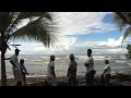
Exploring migrational changes in both northern and southern humpback whales
through participatory mapping of daily sightings in and around Marino Ballena
National Park, the first Marine Park in Mesoamerica. The Park serves as the
heart of sustainable eco-tourism for the region. Three seasons of whale data
have been collected by 10 individuals, generating over 300 sightings and making a Costa Rica organization interested in presenting it at the International Whaling Commission;
-
Protecting the ocean ecosystems from effects of pollution by mapping trash
that has been categorized and collected from the streets and beaches in town
resulting in 11 new trash/recycling mini-centers being built;
-
Training teachers in two local schools to incorporate geospatial
activities into existing education content and student participation in
community geospatial projects. Over 40 students have investigated themes in
Math, Science, Citizen Science, and Global Studies and over 100 students have
participated in the community trash mapping project. This initiative is being
explored with the Ministry of Education for national implementation;
-
Empowering a core group of 10 residents who participate and guide the
education and training initiatives of Geoporter has resulted in over 200
individuals participating in Geoporter activities and events;
-
Gaining media coverage of initiatives in two full-page articles in La
Nación, the national newspaper of Costa Rica, on whale monitoring and trash mapping, and on national TV about participatory whale monitoring;
-
Developing new projects that include mapping vector-transmitted Dengue Fever
through house inspections with the Ministry of Health, Biological Corridor
mapping of animals killed along the Costanera Highway, mapping existing and new
hiking trails, and monitoring and identifying marine and terrestrial birds.
![]()
![]()
![]()
![]()
![]()
![]()
![]()
![]()
Why We Need Your Support?
To continue to build
this model for education and innovation, while making a difference educating community members to
apply GIS and GPS for local projects in Bahía Ballena, we need your support. As teachers and residents began sharing their projects with others outside of the community, these communities are now inquiring how they can receive training to start their own projects or how they can get their own Geoporter. To continue providing local trainings and supporting the projects here in Bahia Ballena as well as reaching out to other communities, support is needed for the
following:
To date this has been an all-volunteer program.
- Rewards for youth who are taking part in the project outside of school hours. (meals, entrance fees to other parks or museums, and transportation to explore areas outside of the community such as Corcovado National Park, Manuel Antonio National Park, San Isidro and Poas Volcano). Many youth have never explored nearby places outside the community that attracts people from around the world. ($1,800)
-
Stipends for community members who have taken time away from their jobs who work on projects and to support the development of community member project managers for the individual projects. ($2,880)
- Project resources such as foam bags to protect donated GPS units and computers, usually carried by foot or bike to trainings. ($1,925)
-
Meeting and project supplies such as a projector, rechargeable batteries (still missing enough rechargeable batteries to supply all GPS units with); waterproof cases to protect GPS units in the rain and ocean waters; plastic laminating paper to make data collection sheets that can be reused after cleaning; permanent markers and cleaning supplies to use with the plastic datasheets; paper and ink to print activities and instructions for residents to use. ($1,300)
- Transportation expenses for bus, taxi or car rental for Geoporter community participants to conduct trainings with other communities not accessible by foot or by bicycle. ($800)
- Room and board and a small stipend for the Geoporter Director to continue residence in Bahía Ballena and be accessible to
other nearby communities for another year ($7,800 ~ $650 per month for one year).
Any support will help us to continue making an impact and let the community apply their acquired geospatial technologies to new projects that will help protect their community to make it one they wish to live in and leave for their grandchildren. It will also support our dream and vision that through education with geospatial technologies, youth, teachers, and residents can be the difference they wish to see in the word.
Other Ways You Can Help
We realize that not everyone has the funds to support projects they believe in. But don't let that stop you from supporting us. In addition to donating, you can:
- Send this to all you know who want to make a difference in our world! Those who believe education can make a difference.
- We can use serviceable digital cameras, GPS units, laptop computers - worn but working well, and airline miles.
- You can also sign up for our newsletter to receive updates.