The Karakoram Anomaly Project combines science, sustainable
development and creative media in the tallest mountain range on earth, the
Karakoram of Pakistan. The Karakoram Anomaly Project will investigate one of
the least understood natural hazards on the planet, and help to protect the
people whose lives are under threat.
![]() The remote Karakoram mountains as seen from the International Space Station
The remote Karakoram mountains as seen from the International Space Station
The Science
The Karakoram Anomaly Project will
investigate one of the least understood natural hazards on the planet, glacial
lake outburst floods.
Glacial lake outburst floods are caused when
an ice or moraine dam containing a glacial lake bursts catastrophically. The
resulting torrent of water, ice and rock rushes downstream, much like a
tsunami. The
Karakoram has suffered more than 30 of these devastating outbursts in the
last 20 years, and it is believed that 80,000 people in the region are
currently at risk.
‘During glacial lake
outburst floods, there is severe loss of lives and physical assets.’ UNDP
Pakistan
![]() A rare photograph of a Glacial Lake Outburst Flood captured in Greenland
A rare photograph of a Glacial Lake Outburst Flood captured in Greenland
The Impact
Glacial lake outburst floods are
not a new phenomenon. However, with current environmental change, their probability has risen in most mountain ranges. Glacial lakes are
particularly dangerous in the Karakoram as they occur at low elevations and
close to settlements. In some cases, potential outbursts allow only 10 to 40
minutes to trigger an alarm for the threatened population to evacuate to
safety.
It is a key time to understand
glacial lake outburst floods in the Karakoram, because of a phenomenon termed
the Karakoram anomaly. The Karakoram anomaly is one of the biggest mysteries of
glacial science. It describes the observation of growing glaciers in the
Karakoram, in contrast to shrinking glaciers in the rest of the world.
“The
Karakoram Anomaly describes the expansion of glaciers in central Karakoram in
contrast to declining glaciers around the world.” Dr Kenneth Hewitt, Wilfrid
Laurier University
There’s a link
between the Karakoram anomaly and glacial lake outburst floods: rapidly
advancing glaciers dam river valleys, causing the accumulation of glacial
melt-water, increasing the risk of glacial lake outburst floods.
![]() Formation of lakes and glacier lake outburst
floods. Example from Medvezhi glacier, Pamir.
Formation of lakes and glacier lake outburst
floods. Example from Medvezhi glacier, Pamir.
The Karakoram Anomaly Project is
designed to investigate exactly how the Karakoram anomaly is changing the
probability of glacial lake outburst floods in the Shimshal, and Hunza valleys
of the Karakoram.
We’ll be trekking and climbing for 60 days across some of the
biggest glaciers on the planet, carrying much needed scientific equipment to
quantify the risk of catastrophic flooding. We’ll then communicate the results
of our work with the local people, to help develop sustainable solutions.
Our work will improve hazard mitigation and
adaptation strategies in the region, and increase the local population’s resilience to
glacial hazards and climate change, potentially saving thousands of lives.
![]() Kashmiri children playing with a shoe in Domkhar - a Himalayan Valley prone to glacial lake outburst floods. Copyrights: Chris Rubey.
Kashmiri children playing with a shoe in Domkhar - a Himalayan Valley prone to glacial lake outburst floods. Copyrights: Chris Rubey.
Community Development
The ultimate goal of the Karakoram
Anomaly Project is to help inform and develop strategies to protect local
communities from glacial lake outburst floods. After all, the purpose of
understanding glacial lake outburst floods in the Karakoram is to protect the
people most at risk.
The Karakoram Anomaly Project will
carry out interactive workshops with the local communities to raise awareness
and advance understanding in respect of the following aspects:
· The causes and
effects of regional climate change;
· The risk and
metrics of glacial lake outburst floods;
· And potential
mitigation and adaptation strategies.
We’re not alone here. We’ve teamed
up with the Karakoram Area Development Organisation and Pakistan
Meteorological Department to develop viable solutions to protect
communities in the Karakoram. We’re also following in the footsteps of
the United Nations Development Programme, which has expressed the need for
the better understanding of glacial lake outburst floods and the development of
solutions in the area.
In addition, we're backed by some of the most prestigious organisations in exploration and development...
![]() They've got our back: The University of Edinburgh, The Captain Scott Society, The Royal Geographical Society, The Mount Everest Foundation, The American Alpin Club, Gilchrist Educational Trust, Laser Technology, The Lord Mayor's Trust
They've got our back: The University of Edinburgh, The Captain Scott Society, The Royal Geographical Society, The Mount Everest Foundation, The American Alpin Club, Gilchrist Educational Trust, Laser Technology, The Lord Mayor's Trust
The Documentary
The Karakoram Anomaly Project is
about developing effective solutions to the glacial lake outburst flood
problem. An absolutely essential part of this is raising awareness about the
phenomenon.
We will document all
expedition stages, the scientific findings and activities carried out in the
field through the aid of photography and film. The result will be professional
photojournalism, time-lapse and repeat photography series and a video
documentary that can be used to communicate with people, both in Pakistan and
across the world. The Karakoram Anomaly Project will display photographs and
scientific results through several exhibitions and presentations including at the
Royal Geographical Society in London.
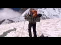
![]() We'll use a professional drone to film our expedition
We'll use a professional drone to film our expedition
Meet The Team
![]()
Hi! I’m Sergiu and I am an
explorer, environmental geoscientist, mountaineer and photographer. I design
multifaceted projects, combining science, mountaineering, creative media, and
community development initiatives. I have eight years experience as leader for
several expeditions throughout the world’s mountain ranges. My notable projects include National Geographic expedition in the Andes, which assessed
landscape changes; Edinburgh University project in Ladakh, which investigated
glacial lake outburst floods; Explorer Club mountaineering expedition in the
Thien Shan Mountains; and hydroponic farming project in Kenya. I am on a mission to
advance society’s mitigation and adaptation strategies to environmental change.
![]()
Hi, I’m Oliver Forster. I am an environmental
geoscientist, sustainability consultant and mountaineering enthusiast. Scientific study has
taken me across the world, from the glaciers and volcanoes of Iceland to
Jamaica’s coral reefs, to the jagged peaks of the Himalayas. In the Himalayas,
I studied the role of glacial lake outburst floods in the 2010 ‘Cloudburst’
event – the extreme convective storm that devastated the people and region of Ladakh. In addition to hard science, I have hands on
experience of environmental and sustainability issues in business. I am passionate about exploring and
conserving the natural world for the benefit of future generations.
![]()
I am a professional
photographer and adventurer, inspired by the beauty of extreme environments and
the wild places of our planet. My passion lies in exploring and photographing
the remote regions of the world and sharing these adventures with others. To
express my vision I create large format, fine art photographs, multi-media
installations and photographic essays. I also aim to contribute to the
understanding of our environment by collaborating with scientists by using photographic
techniques to support scientific research.I have received awards in
several international competitions including Travel and Landscape Photographer
of The Year. My interest in nature photography has taken me to remote lands
such as the Arctic Circle, Mesoamerican barrier reef, and Himalayas where I
climbed the 5th highest mountain in
the world, Makalu (8463m).
![]()
I am a technical-creative
problem solver, and a lover of the wild and remote places of this planet. I
work as a photographer, cinematographer and a product designer. I have directed
and shot international advertising campaigns, remote alpine and rafting
expeditions, short and feature length films, and all manner of work in between.
As an alpinist, I started making many journeys to the Southern Alps of New
Zealand, followed by the European Alps and the Scottish Highlands. I have
partnered with various bodies and companies including Australian Geographic,
Sea to Summit and all of Australia and New Zealand’s prominent alpine clubs for
these expeditions. I have a real passion for teaching, and have worked casually
as an outdoor education instructor.
What we need and what you get
Delivering the project requires a massive logistical, physical and financial effort.
We need your help to make the project happen.
We need £12,000 to purchase
research equipment, organise the community workshops, sustain the team and local porters and craft a video documentary and photographic essays to share
our story with the world.
We have designed unique perks to reward your kind
support. Check them out below!
![]()
![]()
![]()
![]()
![]()
![]()
![]()
Where are the funds going?
The raised funds will be used
towards the fulfilment of The Karakoram Anomaly Project's goals, including:
- Supporting the logistics of this
complex expedition, including payment of a team of 30 collaborators and
porters in Pakistan
- Organising and running two community educational workshops
- Editing multimedia material and crafting a 45 min video documentary and several high
quality photographic essays, including time-lapse and repeat photography series.
![]()
The project involves exploring
remote regions of Central Karakoram and travelling to high altitudes. There are
physical risks associated with this project. However, our team has a wealth of experience in the activities The Karakoram Anomaly project will involve.
We have completed a full risk assessment and crisis management
plan, which has been reviewed by the University of Edinburgh Expeditions
Committee. The risk assessment includes an evaluation of physical, biological,
chemical, and man made hazards and also takes into consideration personal and
third party safety. We've also completed an environmental impact assessment, and endeavour to keep our environmental impact to a minimum.
All team members will have travel and medical insurance for the full length of The Karakoram Anomaly Project covering activities associated with trekking and mountaineering.
In case of an emergency we will use our satellite phone to call the Pakistani
Army for helicopter rescue. Our insurance covers such emergency procedures. All
members have first aid training.
In a nutshell our risk assessment will follow the acronym:
C - Clarify the hazards and risks
R - Reassess and revise it where
necessary
I - Involve all participants in
the process
S - State it simply in writing
I - If it’s too risky – don’t do
it!
S - Share knowledge and experience
For more information visit the
Karakoram Anomaly project official website.
Other ways you can help
If you’re not able to donate we
understand. However, we also hope that you share a passion for international
development, people and preserving our environment so please SHARE, SEND,
PROMOTE and SPREAD THE WORD about what we’re trying to accomplish. The planet
needs us – you can help it by helping the Karakoram Anomaly Project. Please
help our campaign by sharing this on social media. Thank you very much for your
support and we look forward to sharing with you our results and story from the
Karakoram Mountains!


 The remote Karakoram mountains as seen from the International Space Station
 A rare photograph of a Glacial Lake Outburst Flood captured in Greenland
 Kashmiri children playing with a shoe in Domkhar - a Himalayan Valley prone to glacial lake outburst floods. Copyrights: Chris Rubey.
 We'll use a professional drone to film our expedition


